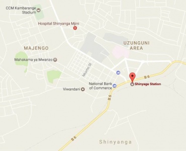
Shinyanga District Council is one of the five Councils and one municipal Council forming Shinyanga Region. The Council lies between latitude 30.20’ and 30.95’ south of the equator and between longitudes 320.30 and 330.30 east of Greenwich Meridian, south of Lake Victoria.
It is bordered to the east by the Kishapu District and Shinyanga Municipal Councils, to the west by the Kahama and Geita Districts, and to the north by Kwimba District and to the south by the Nzega District.
Shinyanga District Council was established in 1st January 1984 under the terms of the provisions of Section 8 and 9 of the Local Government (District Authorities) Act 1982.

The District Council covers an area of 4,212 square kilometers and about 1.7% of the total area (72.9 kms2) is covered by forest reserves. An area of about 1,713.7 kms2 (40.6%) is used for agricultural activities, 2,096.8 kms2 (49.7%) for cattle herding and 210.6 kms2 (5%) for people’s settlement. The remaining area of 118 kms2 (2.8%) of land is of little economic use as it is composed of gulley and rocks.
For administrative purposes, Shinyanga District Council has a normal structure which extends to all levels – the Council, the ward, the village and sub village level which is the uniform structure according to the legislation. The Council is divided into 3 Divisions, 26 Wards, 126 Villages and 856 Sub –Villages as shown in figure 1 below.
Table 1: Administrative divisions
| Division
|
Ward
|
Village
|
Sub – Village
|
| Itwangi
|
10 |
40 |
259 |
| Nindo
|
12 |
68 |
365 |
| Samuye
|
4 |
18 |
100 |
| Total
|
26 |
126 |
856 |
According to the National Census projection, the population of the Shinyanga District Council is estimated to be at 363,500 with an annual growth rate of 2.4%.
The household size was 6 and the only ethnic group is Sukuma. The population density was 66 per square kilometer.
The dominant climate is tropical type of climate with clearly rainy and dry seasons. The mean rainfall ranges from 450 – 990 mm. per annum and normally rains starts between mid – October and ends in May. The distribution of these rains is quite inappropriate for agricultural activities and livestock rearing in the Council.
The Council is characterized by a flat and gently undulating plains covered with low and sparse vegetation.
1.6 Agro-Economic Zones
Ecologically, the Council is divided into three agro-ecological zones with the following soil types:-
Light loam soils in Nindo and Itwangi divisions.
Light loam red soils in Samuye division.
Sandy soils and heavy soils in Itwangi and Nindo divisions.
The Investment Policy is the outcome of the joint efforts by a wide spectrum of stakeholders reflecting public-private smart partnership. Its implementation equally depends on the common efforts of each one of us strive to curve a place for our Council in the global economy for its products in the national market place.
As stated in the national policy, the private sector is the lead implementer, the economic agent responsible for the production of goods and services that will enable the Council to take its rightful place in the national market.
The objective of this investment profile is to fulfill the vision and mission statements of the Council which states:-


OFISI YA MKUU WA MKOA, MKOA WA SHINYANGA, 04 MTAA WA BOMA
Anuani: P.O.Box 320, 37180,SHINYANGA, TANZANIA
Simu: +255 28 2762222
Simu ya Mkononi:
Barua Pepe: ras@shinyanga.go.tz
Hakimiliki@2018. Mkoa wa Shinyanga. Haki zote zimehifadhiwa